Hikes of
La Gomera


Treks La Gomera
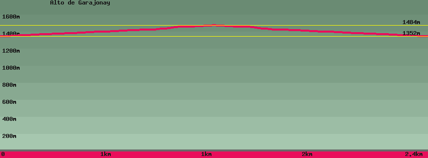
Alto de Garajonay

Data sheet of the trail/hiking path 

1->2 - () Dirt road
 ->
->
 0,40 km
  39 m
39 m  0m
0m
2->3 - () Dirt road
0,43 km 41 m 0m
3->4 - (GR 131) Very good shape
0,08 km 12 m 0m
4->5 - (GR 131) Very good shape
0,28 km 40 m 0m
5->6 - (GR 131) Very good shape
0,28 km 0 m 40m
6->7 - (GR 131) Very good shape
0,08 km 0 m 12m
Go up to the top of Garajonay. On the opposite side of the esplanade, a cemented track goes down to the Contadero parking lot.
7->8 - () Dirt road
0,43 km 0 m 41m
Go down a little further on the track On the right a path goes up towards the summit of Garajonay.
8->9 - () Dirt road
0,40 km 0 m 39m
Go down the cemented track towards Contadero. Arrived on the main road, cross. Opposite at the bottom of the parking lot starts the path that descends to Las Mimbreras, El Cedro and the Hermitage of Lourdes.
Feedback(0) 
Fotos de la ruta
Recommendation for hiking:
Consult previously the state of the hiking paths with the Cabildo